GNSS-Positionierung
Positionen aus GNSS-Daten werden mithilfe der Funktionen gnssconstellation und receiverposition berechnet.
Verwenden Sie die GNSS-Dateilesefunktionen, wie z. B. rinexread und semread, um Satellitennavigations- und Beobachtungsdaten aus RINEX-, SEM-, YUMA- und Galileo-Almanachdateien zu lesen.
Funktionen
Objekte
gnssSensor | Simulate GNSS to generate position and velocity readings |
gnssMeasurementGenerator | Simulate GNSS measurements for scenarios (Seit R2023a) |
gpsSensor | GPS receiver simulation model |
gpsdev | Connect to a GPS receiver connected to host computer |
nmeaParser | Parse data from standard and manufacturer-specific NMEA sentences sent from marine electronic devices |
Blöcke
| GPS | GPS-Sensormessungen mit Rauschen simulieren (Seit R2021b) |
Themen
- GNSS-Simulationsübersicht
Durch die Simulation des globalen Navigationssatellitensystems (GNSS) werden Positionsschätzungen für den Empfänger erstellt.
- Analyze GNSS Satellite Visibility
This example shows how to simulate and analyze GNSS satellite visibility at specified receiver positions and times using a GNSS/GPS ephemeris or almanac file.
- Simulate GPS Sensor Noise
This example shows how to use the GPS block to add GPS sensor noise to position and velocity inputs in Simulink®.
- Estimate GNSS Receiver Position with Simulated Satellite Constellations
Track the position of a ground vehicle using a simulated Global Navigation Satellite System (GNSS) receiver.
- Plot Position of GNSS Receiver Using Live NMEA Data or NMEA Log File
This example shows how to parse information from NMEA sentences and use the obtained information to plot the location.
Enthaltene Beispiele
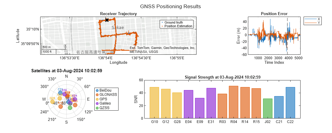
Multi-Constellation GNSS Positioning Using RINEX Files
Estimate GNSS receiver position using RINEX data from multiple satellite systems for improved accuracy and reliability.

Detect Multipath GPS Reading Errors Using Residual Filtering in Inertial Sensor Fusion
Use the residualgps object function and residual filtering to detect when new sensor measurements may not be consistent with the current filter state.

Simulate GNSS Multipath Effects in Urban Canyon Environment
Simulate GNSS multipath for a car with a GPS receiver driving in an urban canyon-like environment and visualize satellite visibility.

Simulate GNSS Multipath Effects on UAV Flying in Urban Environment
Simulate Global Navigation Satellite System (GNSS) receiver noises due to obstructions in a UAV Scenario.

Ground Vehicle Pose Estimation for Tightly Coupled IMU and GNSS
Estimate the position and orientation of a ground vehicle by building a tightly coupled extended Kalman filter and using it to fuse sensor measurements. A tightly coupled filter fuses inertial measurement unit (IMU) readings with raw global navigation satellite system (GNSS) readings. In contrast, a loosely coupled filter fuses IMU readings with filtered GNSS receiver readings.

GPS Legacy Navigation Receiver Positioning Using C/A-Code
Estimate the global positioning system (GPS) receiver position using a multi-satellite GPS baseband waveform. You use the receiver independent exchange format (RINEX) and an almanac file to model the GPS constellation and generate a multi-satellite baseband waveform. Simulate the satellite scenario to get relative positions of satellites with respect to the modeled receiver. For this satellite scenario, model the Doppler shift, delay, and received signal power. Based on these calculations, impair the generated baseband signal with Doppler shift, delay, and noise. This example shows how to estimate the simulated receiver position from this impaired GPS baseband signal.