Proceedings
Featured Presentations
Olav Møyner, SINTEF Digital
November 17
Olav Møyner, SINTEF Digital
Brian Willis, Chevron
Mike Li, Chevron
Tao Sun, Chevron
November 18
Barton Payne, Chevron
Anne Dutranois Coumont, Chevron
Dr. Yuefeng Sun, Texas A&M University
Nishank Saxena, Shell International E&P, Inc.
Detlef Hohl, Shell International E&P, Inc.
Related Resources
We will not sell or rent your personal contact information. See our privacy policy for details.
You are already signed in to your MathWorks Account. Please press the "Submit" button to complete the process.
Pragmatic Digital Transformation
Jim Tung, MathWorks
A shift from 'oil and gas' to 'energy' is taking the industry out of its comfort zone, but digitalization provides a way to manage transition risks. Organizations have defined their high-level digital transformation objectives and are now looking to their engineers and scientists to achieve them. This will involve learning new technologies, collaborating with unfamiliar groups, and proposing new products and services. To meet this challenge, energy companies must master how to systematically use data and models, not only during the research and development stages, but also across groups throughout the lifecycle of the offering. An effective digital transformation plan needs to consider changes in people’s skills, processes, and technology.
Reservoir Modeling Using MATLAB - The MATLAB Reservoir Simulation Toolbox (MRST)
Knut-Andreas Lie, SINTEF Digital
Olav Møyner, SINTEF Digital
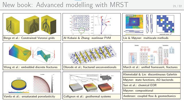
The MATLAB Reservoir Simulation Toolbox (MRST) was originally designed as a research tool for rapid prototyping and demonstration of new simulation methods and modeling concepts for flow in porous media. Over the years, it has developed into a community tool that is used by researchers, students, and reservoir engineers all over the world (e.g., as evidenced in more than 180 Master/PhD theses and 350 papers by authors external to SINTEF). In this talk, we first give a brief overview of MRST and highlight a few application cases. We will then discuss key functionality for rapid prototyping, including discrete differential operators, automatic differentiation, object-oriented simulator frameworks, and state functions; which all together enable you to quickly write simulation engines that are fully differentiable. We will end the talk briefly discussing how MEX EXTENSIONS are used to ensure computational performance is comparable with commercial simulators.
Detecting P- and S-wave Arrivals with Deep Learning Models
David Kirschner, Royal Dutch Shell, Houston
An LSTM network was used to automatically pick the arrival times of P- and S-waves. The network picks events accurately and quickly, obviating the need for human intervention. Although the deep learning model was trained to detect small, local earthquakes in an onshore fold-thrust belt, it is effective in picking small earthquakes in other geologic settings and large earthquakes recorded on global seismic networks based on some initial results.
Enhance the Power of an Interpretation System using MATLAB
Ellen Bonshor-Mayes, ARK CLS Ltd.
Interpretation systems are essential tools used by geoscience professionals in the Exploration and Production (E&P) industry to help view, model and understand the subsurface. MATLAB® is a powerful programming platform designed specifically for engineers and scientists. Whilst interpretation systems are increasingly more powerful in helping geoscientists to both analyse and interpret data in a multi-discipline shared earth environment they often don’t provide all the answers. Frequently E&P companies wish to use proprietary algorithms and workflows to better understand the available data to make better drilling decisions.
GeoDataSync® Framework (GDS-F) provides an easy to use mechanism to connect MATLAB live to interpretation systems allowing data access in real-time. This presentation will discuss and demonstrate how a geoscientist will now be able to access geoscience data (seismic, horizon, wireline etc.), which would otherwise be constrained to the user’s Petrel* project, with the use of MATLAB. This enables the data to be operated on in a specialist way whilst instantaneously being written back, allowing immediate visualisation of the enhanced data in Petrel*. It is this more interactive functionality that opens the possibility for MATLAB prototypes to be productised into tools in-house for use by asset teams.
Exploring Digital Stratigraphy using Computational Stratigraphy Explorer (CSE)
Brett Hern, Chevron
Brian Willis, Chevron
Mike Li, Chevron
Tao Sun, Chevron
Computational Stratigraphy is a new Chevron proprietary reservoir characterization and modeling technology. Computational stratigraphy generates geologically plausible reservoir analogues through simulation of the processes of sediment transport and deposition. During each simulation, snapshots of the surface geometry, water flow velocity, and sediment properties near the basin surface are recorded. These snapshots help delineate the key extrinsic and intrinsic controls of stratigraphic architectures, sedimentary body geometry, and other reservoir properties and heterogeneities in basins with various geologic settings.
Conventional reservoir modeling tools are challenged to view, explore and analyze these 3D models interactively and efficiently because of their dense spatial and temporal resolutions and their non-standard data about the evolution of a depositional system. The Computational Stratigraphy Explorer (CSE) was developed to enable geoscientists to visualize, explore, and analyze computational stratigraphy models interactively. CSE is an interactive application developed in MATLAB. It relies on the flexible visualization capability and interactivity available with standard MATLAB components.
Interactive programs developed in the MATLAB environment can be deployed as stand-alone executable applications or dynamic libraries that can be launched from existing applications such as Petrel. This facilitates efficient technology development and engagement of geoscientists for iterative improvement of the software.
Wavelets – A hidden gem for Artificial Intelligence in seismic interpretation
Akhilesh Mishra, MathWorks
Artificial Intelligence (AI) has become very popular for solving problems in seismic data processing. However, geoscientists spend significant efforts in labeling the data and developing complex signal or image processing algorithms to prepare data for AI algorithms. We demonstrate the use of wavelets in MATLAB to simplify these workflows - specifically, the use of wavelet transforms to enhance two common seismic processing tasks.
(1) Automatically pick the arrival times and duration of P- and S-waves: We use the continuous wavelet transform (CWT) to generate 2-D time-frequency maps of time series data, which can then be used as image inputs for deep convolutional neural networks (CNN). The ability of the CWT to simultaneously capture high frequency shorter duration and low frequency longer duration components in time series data makes the wavelet-based time-frequency representation particularly robust when paired with deep CNNs.
(2) Seismic trace analysis: Some key features used to define seismic attributes can be difficult to extract from the seismic traces due to noise, clutter, trends etc. Wavelet based multiresolution analysis is a powerful framework for extracting these relevant features from complex traces without adding any spatial distortions or artifacts. These features can be paired with AI models for classification. Our recent results obtained from this approach are promising for an automated seismic interpretation model, increasing the productivity of the interpreter by ~10x.
Seismic Dip Guided Horizon Interpretation in Petrel with MATLAB
Brett Hern, Chevron
Barton Payne, Chevron
Anne Dutranois Coumont, Chevron
Seismic horizons are geologic features observed in seismic data that indicate a relatively consistent change in acoustic impedance over a wide area. Usually, these horizons have a relatively shallow orientation because natural processes lead the earth’s surface to be mostly flat during deposition. Existing seismic horizon auto-tracking algorithms take advantage of this fact to work in most datasets. There are however various structural deformations which can cause important geologic features to be rotated to steep dips. To solve this business problem, we designed and implemented a seismic dip guided horizon auto-tracking algorithm which uses commercial dip attribute volumes to guide the horizon tracker. We chose to implement our algorithm in MATLAB because it is an efficient language for rapid prototyping, offers flexible visualizations for algorithm validation, and efficient deployment through the MATLAB Compiler SDK. The efficient deployment of iteratively improved algorithm designs was critical to the success of this tool. We needed to obtain feedback on the algorithm results from a wide range of Geoscientists and on datasets from diverse geological environments. Deploying early prototypes of the algorithm into a Petrel plugin allowed rapid iteration based on user feedback.
We’ve implemented an interactive troubleshooting tool to investigate whether initial results could be improved by adjusting algorithm parameters or if fundamental changes to the algorithm were required. This iterative algorithm refinement process resulted in an efficient, easy-to-use, and highly accurate horizon auto-tracker which succeeded where existing commercial software was unsuccessful or inefficient.
A Stand-Alone Open-Source MATLAB Program for Sequence Stratigraphic and Chronostratigraphic Analysis of Geological Data
Dr. Adewale Amosu, Texas A&M University and San Jacinto College
Dr. Yuefeng Sun, Texas A&M University
Sequence stratigraphy investigates the order in which depositionally-related stratal successions or time-rock units were laid down in the available space or accommodation. Chronostratigraphy tracks the sequence of deposition and changes in the character of sedimentary deposits in geologic time. Interpreted surfaces are considered as snapshots of geologic time and chronostratigraphic charts or wheeler diagrams are tools used to depict time stratigraphy by flattening the interpreted surfaces.
Historically, numerous sequence stratigraphy schools of thought or methodologies with distinctly different hiatial surfaces and depositional cyclicities have been proposed. In addition to the confusing terminology created by this, existing software for sequence stratigraphy are not open-source and can’t be applied to outcrop image data. It is therefore important to develop open-source software that can navigate the multiple frameworks of the different methodologies and that can incorporate outcrop image data.
We have developed WheelerLab, a stand-alone open-source interactive program that facilitates the sequence stratigraphic and chronostratigraphic analysis of geological data (seismic sections, outcrop data and well-sections). WheelerLab adds some important functionalities not present in commercially available software: it can be used for analysis within the framework of multiple sequence stratigraphy methodologies; it incorporates new types of data including outcrop images and interpreted well-sections; and it generates a dynamic chronostratigraphic section. The program enables multiple methodologies by giving the user flexible interpretational control over the transformation. The program generates dynamic wheeler diagram that sequentially depicts the evolution of the chronostratigraphic chronosomes concurrently with the evolution of interpreted genetic stratal packages. WheelerLab can also be used to create synthetic sequence stratigraphic sections and the corresponding synthetic chronostratigraphic sections.
Content based image retrieval (CBIR) using deep neural networks
Christopher Thiele, Shell International E&P, Inc.
Nishank Saxena, Shell International E&P, Inc.
Detlef Hohl, Shell International E&P, Inc.
Images and image processing are deeply embedded in many business workflows in the energy industry. Shell maintains image stores in excess of 50 PBytes in the form of (e.g.) seismic data, microcomputer tomography (CT) and microscopy images of rocks and catalysts, borehole core and sidewall images, satellite and drone image data and asset surveillance camera data at multiple resolutions, scales and wavelengths. Finding similar images in our large data stores based on content and not metadata is a generic task. Metadata are often out of date, subject to change, or simply not available. Traditional image processing methods such as feature identification work well for small and few images but do not scale to large images or data repositories due to computational demand.
Modern deep learning excels at extracting relevant features from images based on supervised and unsupervised learning “by itself” and with little computational effort. In this contribution we focus on “Digital Rock” technology where scanned images of rocks are analyzed using computer analysis and computer simulation to replace expensive and time-consuming laboratory experiments. Experts often wish to consult existing laboratory and pre-computed simulation results for rock samples similar to newly acquired ones. We discuss how CBIR algorithms can help identify similar rock samples. We explore the challenges that micro-CT pore images pose to CBIR methods, and we evaluate the performance of CBIR algorithms based on traditional feature extraction methods as well as deep learning techniques.
After a comparison of different deep learning architectures and training approaches, we conclude with an outlook on scalable CBIR algorithms and implementations for large collections of three-dimensional pore images. Our CBIR algorithms were implemented using MATLAB's toolboxes for parallel computing, deep learning, and image processing. The MATLAB platform allowed us to efficiently develop and compare numerous algorithms and ideas in an interactive, GPU-accelerated environment.
Borehole Acoustic Wavefield Modeling with a “Cluster-in-a-Box"
Kristoffer Walker, Chevron
Borehole acoustic logging involves measuring the elastic properties of the Earth with tools that move through the borehole as part of a drilling pipe or via a wire. A source transmits an acoustic wave into the borehole fluid and excites wave modes that are recorded by a receiver array on the same tool. Computational modeling of borehole acoustic wavefield propagation has greatly improved our understanding of this physics, which has resulted in fit-for-purpose algorithms to measure properties of the Earth.
Traditionally borehole acoustic wavefield modeling is carried out on HPC clusters. That protocol of parallelizing computations works well for many problems. However, it comes at the cost of: developing and maintaining codes that are harder to debug; having performance limited by network communication speeds; sharing cluster resources with others; needing a queue system that is separate from your modeling software to manage jobs; and most importantly, using an HPC cluster.
Chevron has addressed this problem by using MATLAB’s rich and user-friendly GUI development features, embracing cloud-based distributed computing technologies, and utilizing advances in computational hardware and compilers. Specifically, we developed a shared memory wavefield simulation code that capitalizes on cache blocking, enabling us to achieve cluster speeds on a single multi-processor virtual machine. We created a MATLAB GUI infrastructure for the entire system spanning model creation, job management, data analysis, and results archiving. Our program represents a “cluster in a box”, and generates results by spinning up only the computational resources it needs for the job, greatly reducing the total cost relative to using a physical cluster due to the pay-as-you-go cloud-based cost structure. For us the value proposition of using MATLAB is simply that is makes us agile, allowing us to accelerate our growing of capabilities and delivery of results faster than any of the other alternatives.
Seismic full waveform inversion algorithms and their numerical behaviour
Kristopher Innanen, University of Calgary
Seismic full waveform inversion (FWI) comprises the use of Newton methods to update subsurface geological property models, in which data are simulated with maximally complete (e.g., elastodynamic) modeling of seismic data. It currently represents the state of the art in geological image-forming, but many basic and applied research questions remain and are being addressed. At CREWES we have developed a set of time and frequency domain FWI codes in the MATLAB environment, for purposes of analysis of algorithms and small-scale field testing. This talk will give an overview of methods, results and conclusions our research group has produced using these codes.
Microseismic Digitalization at the Quest CCS Facility
Stephen Harvey, Shell Canada
Shell has been operating the Quest Carbon Capture and Storage (CCS) project in Canada since 2015. In order to demonstrate containment and conformance of the injected CO2; a Measurement, Monitoring and Verification (MMV) plan has been implemented. Although Quest is in an extremely quiet tectonic location, induced seismicity has been recognized as a potential risk for all large-scale injection sites which has resulted in microseismic monitoring as a key component of the Quest MMV Plan.
This presentation showcases how visualization and self-service analytics tools, when applied to microseismic monitoring, have allowed for a democratization of digitalization. Self-service tools are encouraging a wider uptake of data science capabilities in the organization and a shift towards more accessible in-house analytical capabilities.
Model-Based Design for Drilling Systems Development: Practical perspectives from other industries on Model-Based Design
Sameer Prabhu, MathWorks
The drilling industry is going through a transformation through increased adoption of embedded systems which increases the complexity of drilling systems and stresses the traditional processes used to develop these systems. The industry is addressing this challenge by adopting Model-Based Design, where models are used throughout the design and development phase – from multi-domain models that allow system level design and optimization, to reusing those models for generating embedded code and real-time system level testing, as well as Digital Twins in operating scenarios. As the industry navigates this transformation, it can learn from the experience of other industries that have made this transition, such as automotive, aerospace, and others, in order to make this a successful transition, as well as build on the lessons learned from the other industries. This talk will provide perspectives from other industries and draw parallels to provide practical approaches to deploying Model-Based Design for drilling systems development.
Lessons in applying Model-Based Design for systems and controls engineering in alternative energy startup environment
Igor Braverman, Boston Metal
Engineering startup environment is characterized by resource limited small teams, required to meet aggressive cost targets and timelines for the development of complex systems. It is often essential to quickly scale up technology, build insight into system behavior, and adopt agile methodologies for systems and controls development, while minimizing the need for building costly hardware prototypes. Additional challenges come from the need to communicate the latest system design and architecture to the whole engineering team, perform tradespace studies to explore different system architecture concepts, inform control system design, and produce cost, power and other system budgets.
This talk focuses on the author’s experience in establishing and implementing systems and controls development process at various startups, using Mathworks Model-Based Design to address these challenges. The use of Object-Process Methodology is proposed to create the model of the development process to improve the understanding of how various Mathworks products and modeling artifacts facilitate each stage of the system development. This includes the use of Requirements Toolbox for requirements capture, System Composer for system architecture design, Simulink, Stateflow and Simscape for the dynamic system and control system modeling, Embedded Coder for automatic code generation, Simulink Test for unit testing and integrated system verification and Simulink Project for revision control and file management.
MathWorks and NI Interoperability
Joel Van Sickel, MathWorks
Learn how MathWorks and NI are working together to ensure that you can combine the best from both vendors to meet your requirements.
These workflows can support anything from requirements and test design down to detailed HIL setups. This talk will mainly focus on high level workflows but will briefly touch on details such as deploying models to both the CPUs and FPGAs of NI hardware.
Drilling optimization for oil and gas wells
Peter Brady, MathWorks Australia
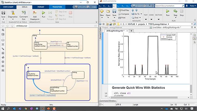
The extended downturn in the Oil & Gas demands sizable expenditure cuts; one way to do so and maintain or improve quality levels is by increasing automation. Deciding the best drilling parameters for optimal rate of penetration (ROP) remains a complicated and highly manual task that can benefit greatly from automation. Moreover, the drilling process is extremely dynamic with many variable and changing parameters that can affect the ROP and overall performance of the rig. Having a deeper understanding of historical data and what affects drilling performance will allow operators to better plan drilling, potentially increase rate of penetration and reduce overall cost of the well.
In this talk, we demonstrate the use of MATLAB to better understand and leverage historical data to optimize the drilling process. The data includes the occurrence (and frequency) of mud motor stalls, downhole wellbore conditions, drilling parameters and the equipment and configurations that have produced the best historical performance. MathWorks products are ideally suited to this workflow as they allow quick investigation of the data and rapid prototyping of algorithms.
Science-ing up deep earth drill bit design with MATLAB Production Server
Christopher Bremer, NOV ReedHycalog
Polycrystalline diamond compact (PDC) bits have revolutionized oil and gas exploration in recent decades and continue to show dramatic improvements in drilling speed and durability. This progress is driven by the work of research engineers, material scientists, and laboratory technicians. In order to stay competitive, ReedHycalog needs a fast track for pushing rapidly evolving technology from the lab to bit designers to the factory floor. Our software package, “Orbit”, enables engineers to evaluate their CAD designs against cutting edge scientific models. To complete the loop, we continuously validate and improve these models using field data from the finished product. The speaker talks about how MATLAB Production Server allows NOV to rapidly integrate current R&D into their software in order to “science up” the bit design process.
Changing the way you use Simulink - What's new with Simulink
Ed Marquez Brunal, MathWorks
Simulink has improved significantly over the last few years to address the growing needs of our users. This session will introduce you to new Simulink capabilities that enable you to work more efficiently and improve your development. You will learn about new features for editing, componentizing, modeling run-time software, speeding up your simulations, and more.
Website auswählen
Wählen Sie eine Website aus, um übersetzte Inhalte (sofern verfügbar) sowie lokale Veranstaltungen und Angebote anzuzeigen. Auf der Grundlage Ihres Standorts empfehlen wir Ihnen die folgende Auswahl: .
Sie können auch eine Website aus der folgenden Liste auswählen:
So erhalten Sie die bestmögliche Leistung auf der Website
Wählen Sie für die bestmögliche Website-Leistung die Website für China (auf Chinesisch oder Englisch). Andere landesspezifische Websites von MathWorks sind für Besuche von Ihrem Standort aus nicht optimiert.
Amerika
- América Latina (Español)
- Canada (English)
- United States (English)
Europa
- Belgium (English)
- Denmark (English)
- Deutschland (Deutsch)
- España (Español)
- Finland (English)
- France (Français)
- Ireland (English)
- Italia (Italiano)
- Luxembourg (English)
- Netherlands (English)
- Norway (English)
- Österreich (Deutsch)
- Portugal (English)
- Sweden (English)
- Switzerland
- United Kingdom (English)
Asien-Pazifik
- Australia (English)
- India (English)
- New Zealand (English)
- 中国
- 日本Japanese (日本語)
- 한국Korean (한국어)