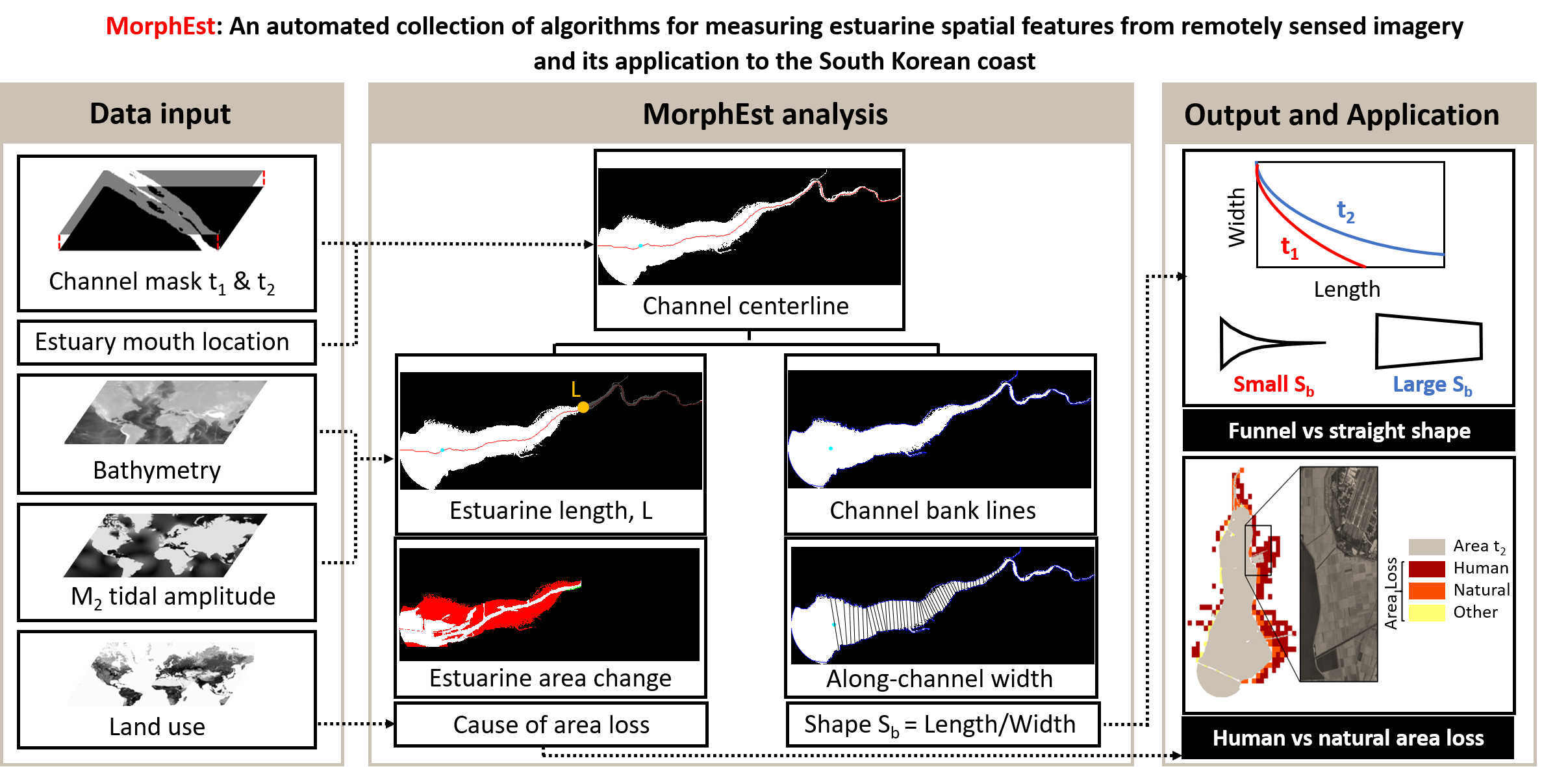
MorphEst - Estuary planform geometry
Toolbox for analyzing estuary planform geometry from channel masks (estuarine length, convergence length, shape, area change)

Sie verfolgen jetzt diese Einreichung
- Aktualisierungen können Sie in Ihrem Feed verfolgter Inhalte sehen.
- Je nach Ihren Kommunikationseinstellungen können Sie auch E-Mails erhalten.
Zitieren als
Nathalie Schieder (2026). MorphEst - Estuary planform geometry (https://de.mathworks.com/matlabcentral/fileexchange/86173-morphest-estuary-planform-geometry), MATLAB Central File Exchange. Abgerufen .
Quellenangaben
Inspiriert von: RivMAP - River Morphodynamics from Analysis of Planforms
Allgemeine Informationen
- Version (653 KB)
Kompatibilität der MATLAB-Version
- Kompatibel mit allen Versionen
Plattform-Kompatibilität
- Windows
- macOS
- Linux
| Version | Veröffentlicht | Versionshinweise | Action |
|---|---|---|---|
| 1.0.1 | Example text files are now included. |
||
| 1.0.0 |

