satelliteScenarioViewer
Description
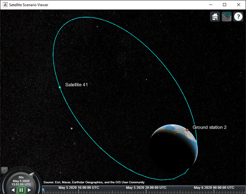
The satelliteScenarioViewer object represents a 3D visualization
of the satelliteScenario object. Use this object to focus the camera onto the
satellite or the ground station by double-clicking the satellite or ground station. Once
focused, you can rotate the camera and it will orbit around the selected satellite/ground
station and not be allowed to pan out. To unfocus, you must double-click elsewhere in the
viewer or press the home button.
Creation
Syntax
Description
satelliteScenarioViewer( creates a
3-D or 2-D satellite scenario viewer for the specified satellite scenario. Satellite
Scenario Viewer is a 3-D map display and requires hardware graphics support for
WebGL™.scenario)
v = satelliteScenarioViewer(scenario)
satelliteScenarioViewer(
sets properties using one or more
optional name-value arguments. For example,
scenario,Name=Value)satelliteScenarioViewer(scenario,Position = [1 1 500 500]) sets the
position to [1 1 500 500].
Properties
Object Functions
campos | Set or get position of camera for Satellite Scenario Viewer |
camheight | Set or get height of camera for Satellite Scenario Viewer |
camheading | Set or get heading angle of camera for Satellite Scenario Viewer |
camroll | Set or get roll angle of camera for Satellite Scenario Viewer |
campitch | Set or get pitch angle of camera for Satellite Scenario Viewer |
camtarget | Set camera target for Satellite Scenario Viewer |
play | Play satellite scenario simulation results on viewer |
showAll | Show all graphics in viewer |
hideAll | Hide all graphics in satellite scenario viewer |
Examples
Version History
Introduced in R2021a
