getMap
Get raster map from server
Description
A = getMap(server,mapRequestURL)server, and stores
it in A. Parameters in the URL,
mapRequestURL, define the map. The
getMap function also updates the
RequestURL property of the server with
mapRequestURL.
Most of the time, you can read a WMS map using wmsread function instead of the getMap
function. Use the getMap function when:
Working with non-EPSG:4326 reference systems
Creating an animation of a specific geographic area over time
Retrieving multiple layers from a WMS server
Examples
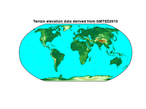
Search the WMS Database for a layer containing terrain elevation data from the WMS server hosted by MathWorks®.
layers = wmsfind("mathworks",SearchField="serverurl");
layer = refine(layers,"elevation");
Create a web map server object and a map request object. Change the background color of the map request to cyan.
server = WebMapServer(layer.ServerURL);
mapRequest = WMSMapRequest(layer,server);
mapRequest.BackgroundColor = [0 255 255];
Read the map from the server.
A = getMap(server,mapRequest.RequestURL);
R = mapRequest.RasterReference;
Display the map.
figure
worldmap world
geoshow(A,R)
plabel off
mlabel off
title(layer.LayerTitle)
Input Arguments
Output Arguments
Tips
getMap accesses the Internet to retrieve the map. Periodically, the
WMS server is unavailable. Retrieving the map can take several minutes.
Version History
Introduced before R2006a