areamat
Surface area covered by nonzero values in binary data grid
Syntax
A = areamat(BW,R)

A = areamat(BW,R,ellipsoid)

[A, cellarea] = areamat(...)
Description
A = areamat(BW,R) returns the surface area covered by the elements of the
binary regular data grid BW, which contain the value 1
(true). BW can be the result of a logical
expression. Specify R as a GeographicCellsReference object. The RasterSize
property of R must be consistent with
size(BW).
The output A expresses surface area as a
fraction of the surface area of the unit sphere (4*pi), so the result
ranges from 0 to 1.
A = areamat(BW,R,ellipsoid) calculates the surface area on the ellipsoid
or sphere defined by the input ellipsoid, which can be a referenceSphere, referenceEllipsoid, or oblateSpheroid object, or a vector of the form [semimajor_axis
eccentricity]. The units of the output, A, are the
square of the length units in which the semimajor axis is provided. For example, if
ellipsoid is replaced with
wgs84Ellipsoid('kilometers'), then A is in
square kilometers. If you do not specify ellipsoid and
R has a non-empty GeographicCRS property, then
areamat uses the ellipsoid contained in the
Spheroid property of the geocrs object in the
GeographicCRS property of R.
[A, cellarea] = areamat(...) returns a
vector, cellarea, describing the area covered by
the data cells in BW. Because all the cells in
a given row are exactly the same size, only one value is needed per
row. Therefore cellarea has size M-by-1,
where M = size(BW,1) is the number of rows in BW.
Examples
Tips
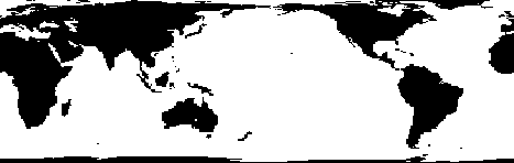
Given a regular data grid that is a logical 0-1 matrix, the areamat
function returns the area corresponding to the true, or 1, elements. The input data grid
can be a logical statement, such as (A > 0), which is 1 everywhere
that A is greater than 0, and 0 everywhere else. This image shows the
result when A contains global elevation data.