Labeling
R2026bUse the Multi-Sensor Labeler app to interactively label ground truth data across multiple time-synchronized signals representing the same scene. You can label videos, image sequences, and lidar point cloud signals simultaneously. The app supports a wide range of ROI label types, including rectangles, rotated rectangles, cuboids, projected cuboids, lines, polygons, pixel labels, and semantic point labels. You can also apply scene labels to classify entire frames across all signals. To get started, see Get Started with Multi-Sensor Labeler.
To accelerate the labeling process, the app provides built-in automation algorithms for object tracking and temporal interpolation across frames. You can also develop and import custom automation algorithms. For more information, see Automate Labeling for Multi-Sensor Data.
Once labeling is complete, export the labeled data as a groundTruthMultiSensor object and create training data for deep learning
workflows. Use pointCloudObjectDetectorTrainingData to create training data for 3-D
object detection networks such as PointPillars, or use semanticPointLabelTrainingData to create paired datastores for training
3-D semantic segmentation networks such as RandLA-Net. For more information, see Export
Multi-Sensor Ground Truth and Create Training Data.
To define label definitions programmatically outside the app, use the labelDefinitionCreatorMultiSensor object to create, inspect, and manage
label hierarchies including sublabels and attributes. You can build
groundTruthMultiSensor objects programmatically by combining data
sources with label definitions, ROILabelData objects for ROI labels, and SceneLabelData objects for scene labels. You can also import
programmatically created ground truth objects into the app for further review and
labeling.
Apps
| Multi-Sensor Labeler | Label ground truth data in images, videos, and point clouds across multi-sensor scenes (Since R2026b) |
Functions
Topics
Get Started
- Get Started with Multi-Sensor Labeler
Interactively label ground truth data in images, videos, and point clouds simultaneously using the Multi-Sensor Labeler app.
- Choose an App to Label Ground Truth Data (Computer Vision Toolbox)
Decide which app to use to label ground truth data: Image Labeler, Video Labeler, Multi-Sensor Labeler, Signal Labeler, or Medical Image Labeler. - Keyboard Shortcuts and Mouse Actions for Multi-Sensor Labeler
Use keyboard shortcuts and mouse actions to increase productivity while using the Multi-Sensor Labeler app. - Migrate from Ground Truth Labeler and Lidar Labeler Apps to Multi-Sensor Labeler App
Migrate your labeling workflows from the Ground Truth Labeler and Lidar Labeler apps to the unified Multi-Sensor Labeler app. - Control Playback of Signal Frames for Labeling
Control which signal frames display in the Multi-Sensor Labeler app during playback.
Label Ground Truth
- Label Pixels for Semantic Segmentation (Computer Vision Toolbox)
Label pixels for training a semantic segmentation network by using a labeling app. - Use Sublabels and Attributes to Label Ground Truth Data (Computer Vision Toolbox)
Learn how ROI sublabels and attributes work in labeling apps. - View Summary of Ground Truth Labels (Computer Vision Toolbox)
View a summary of ROI and scene labels in a labeling app session.
Automate Labeling
- Create Custom Automation Algorithm for Labeling
Create a custom automation algorithm using a class-based interface to use in a labeler app. - Create Automation Algorithm Function for Labeling (Computer Vision Toolbox)
Create a custom automation algorithm function to use in a labeling app. - Temporal Automation Algorithms
Create a time-based custom tracking algorithm to import into a labeling app.
Featured Examples
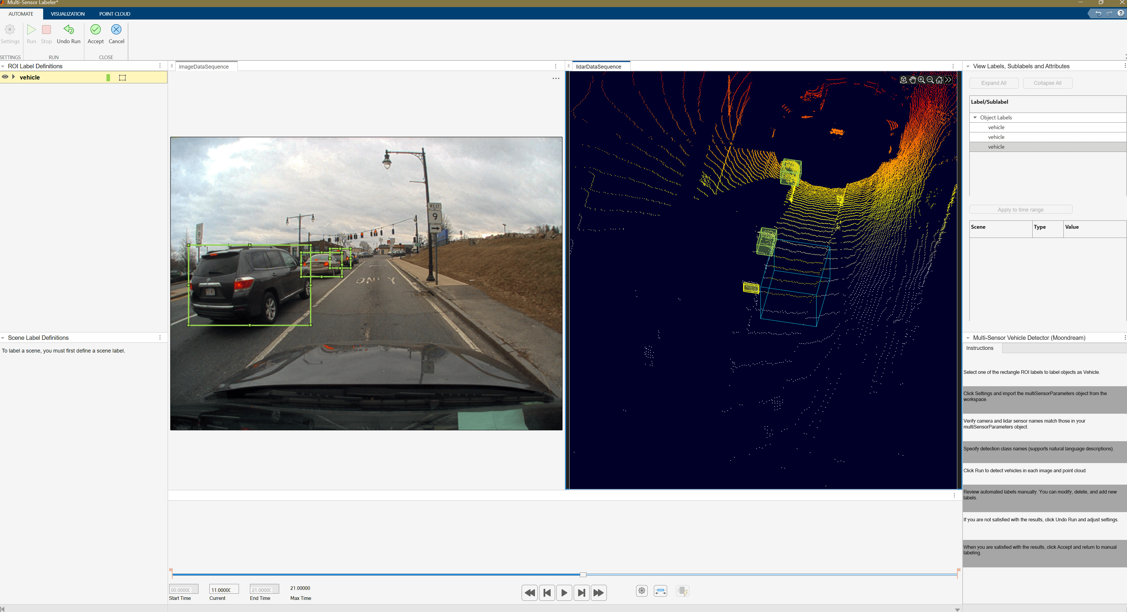
Automate Multi-Sensor Ground Truth Labeling Using Moondream Vision-Language Model
Automate multi-sensor ground truth labeling using the Moondream vision-language model and the Multi-Sensor Labeler app.
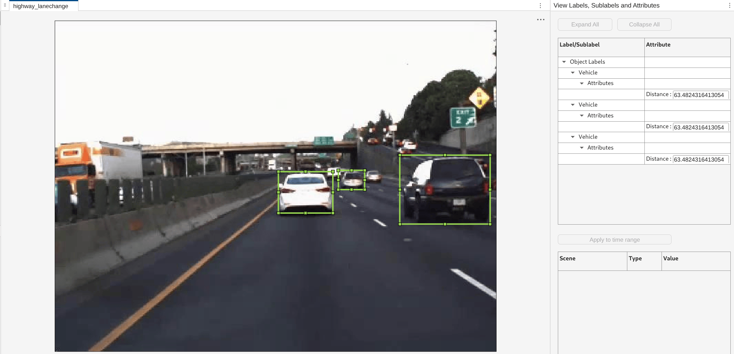
Automate Vehicle Labels and Distance Attributes Using YOLOv2 in Multi-Sensor Labeler
Create a custom automation algorithm for the Multi-Sensor Labeler app that detects vehicles using YOLOv2 and estimates their distances from the ego vehicle.
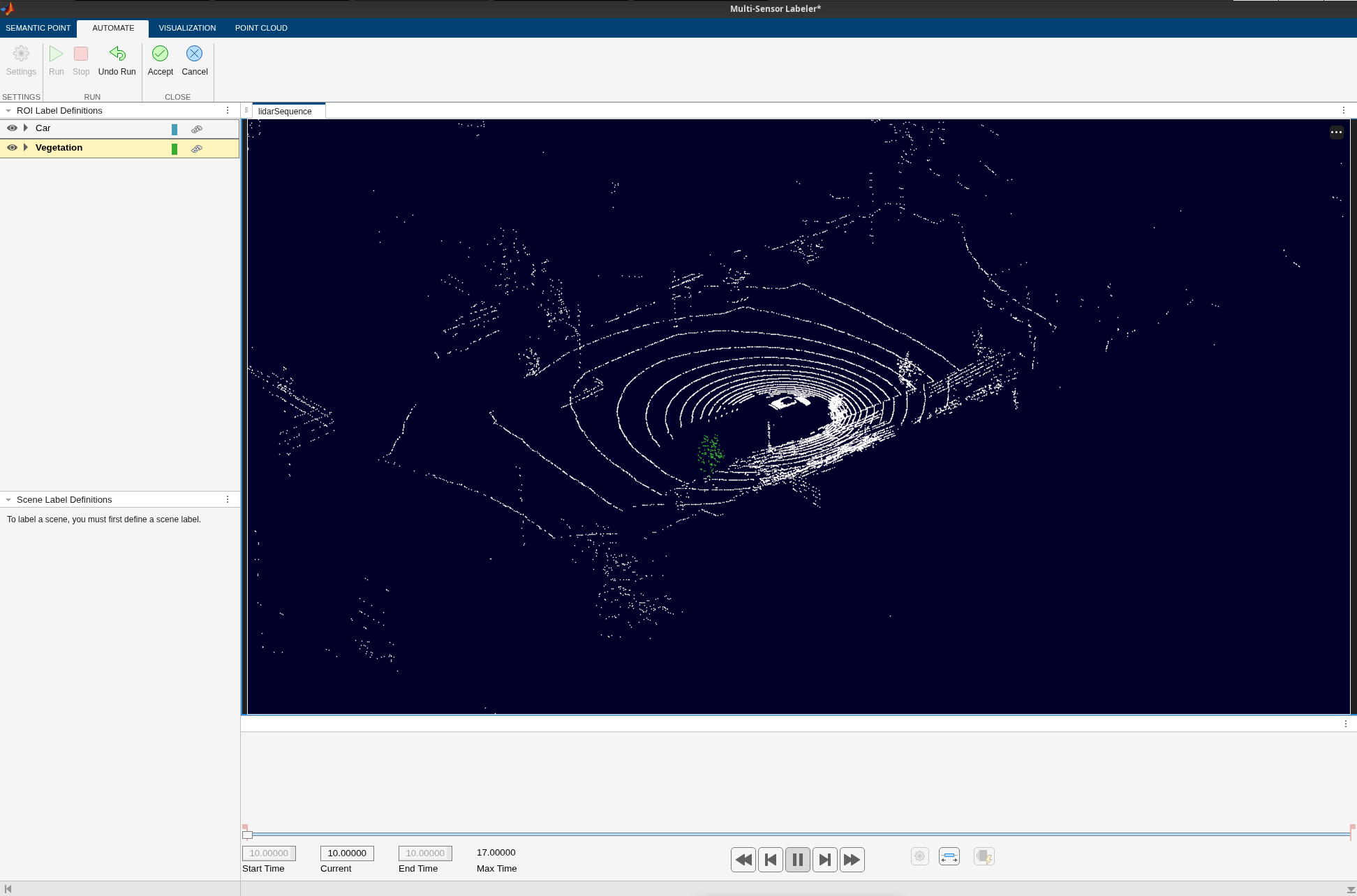
Automate Point Cloud Labeling Using SNAP Model
Segment point clouds automatically or interactively in the Multi-Sensor Labeler app using the pretrained SNAP model.
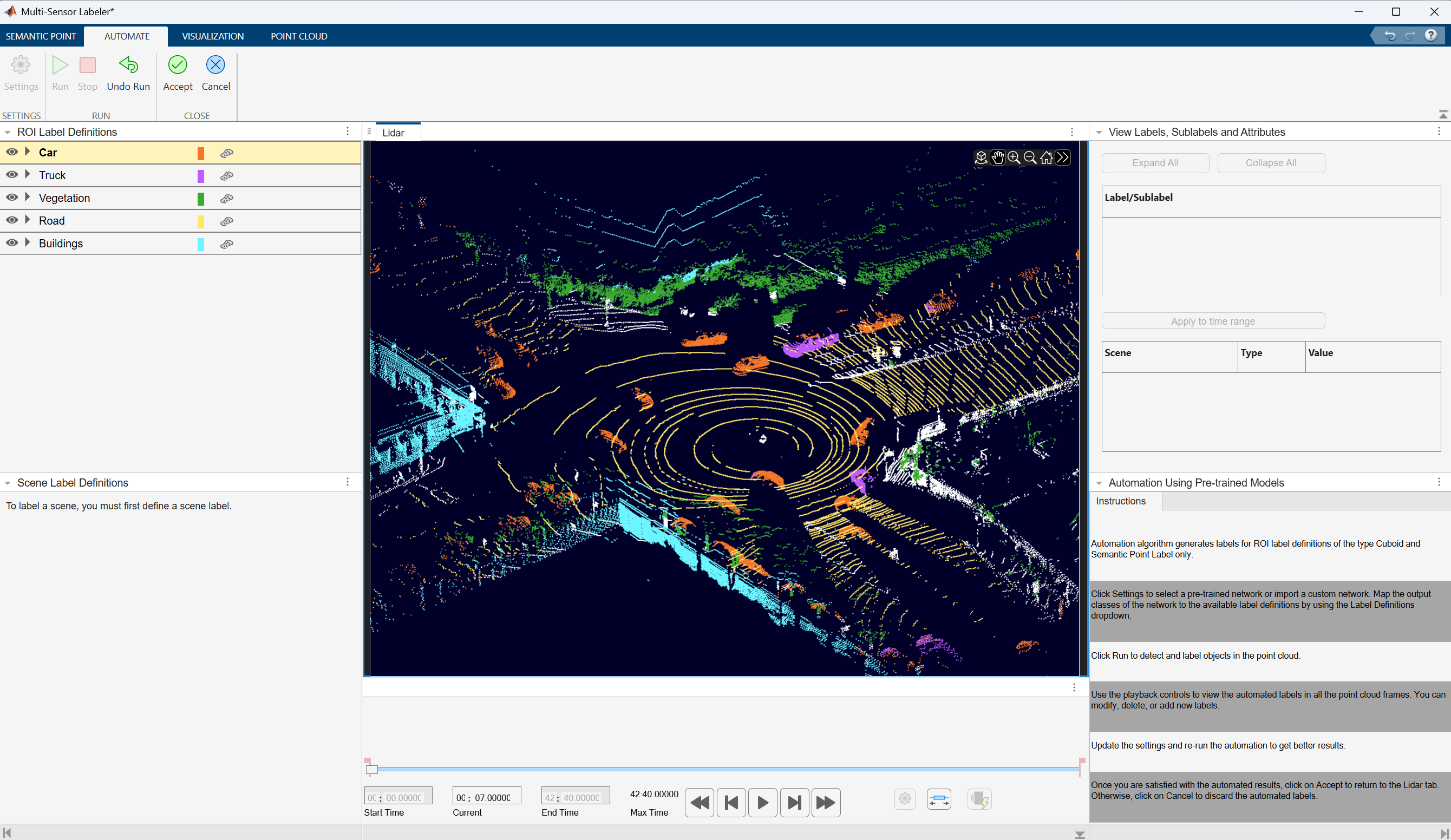
Automate Ground Truth Labeling for Point Cloud Using Pretrained Deep Learning Model
Automate semantic segmentation labeling of point cloud data using a pretrained RandLA-Net model in the Multi-Sensor Labeler app.
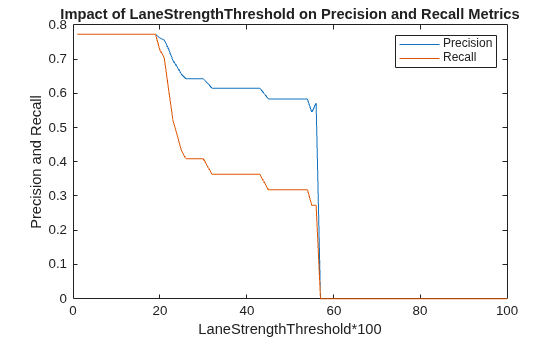
Evaluate Lane Boundary Detections Against Ground Truth Data
Compare ground truth data against results of a lane boundary detection algorithm and tune algorithm parameters for best detection results.
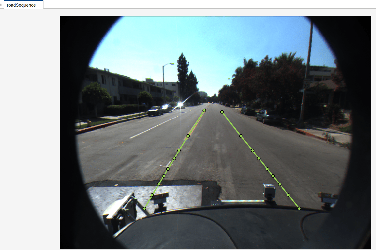
Automate Ground Truth Labeling of Lane Boundaries
Create automation algorithm that automatically labels lane boundaries in the Multi-Sensor Labeler app.
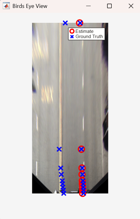
Evaluate and Visualize Lane Detections Against Ground Truth
Evaluate the performance of lane boundary detection against known ground truth by computing a goodness-of-fit measure on a per-frame basis.

